
1) These data main included the GPR-surveyed ice thickness of six typical various-sized glaciers in 2016-2018; the GlabTop2-modeled ice thickness of the entire UIB sub-basins, discharge data of the hydrological stations, and related raw & derived data. 2) Data sources and processing methods: We compared the plots and profiles of GPR-surveyed ice bed elevation with the GlabTop2-simulated results and selected the optimal parametric scheme, then simulated the ice thickness of the whole UIB basin and assessed its hydrological effect. These processed results were stored as tables and tif format, 3) Data quality description: The simulated ice thickness has a spatial resolution of 30 m, and has been verified by the GPR-surveyed ice thickness for the NSE values were above 0.9. The maximum error of the GPR-measured data was ± 2.4 m, within the quoted glacier error at ± 5%. 4) Synthesizing knowledge of the ice thickness and ice reserves provides critical information for water resources management and regional glacial scientific research, it is also essential for several other fields of glaciology, including hydrological effect, regional climate modeling, and assessment of glacier hazards.
2020-08-23
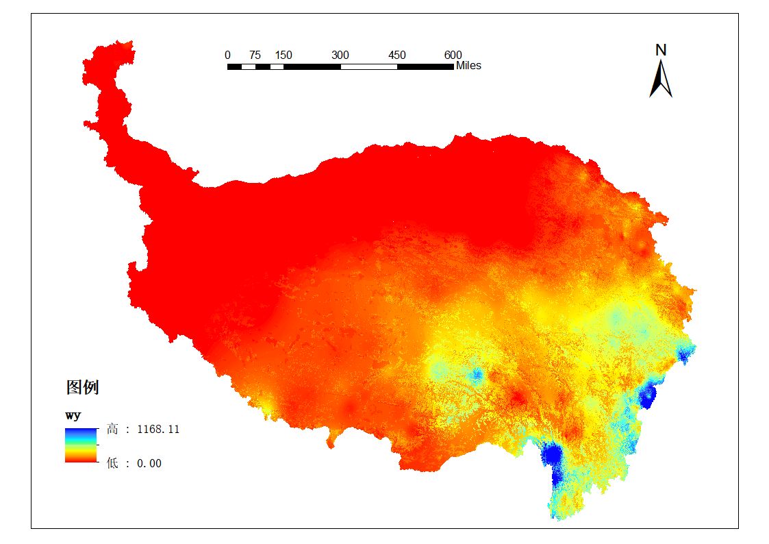
青藏高原的水土资源匹配数据,由站点气象数据(2008-2016年,国家气象数据共享网)经过彭曼公式计算得出的潜在蒸散发数据,利用土地利用的不同土地类型,根据下垫面影响系数计算现有土地利用下的蒸散发量;以及气象数据中的站点降雨数据插值得到的降雨数据,根据两者差值得到水土资源匹配系数。实际降雨与现有土地利用条件下的需水量之间的差值来反映水土资源的匹配性,数值越大匹配性越好。水土资源的匹配情况的空间分布能为进一步了解青藏高原的农牧业资源情况做铺垫。
2020-01-14
中亚五国1980-2015年农业水资源供需和开发利用数据集,来源全球陆面数据同化系统,分别包括基于Noah、Mosaic和VIC模型输出的降水、蒸发和径流数据。该数据集时间和空间分辨率高,具有较好的数据精度,在全球尺度和区域尺度研究中应用广泛。Noah、Mosaic和VIC模型的降水、蒸发和径流模拟结果在空间分布上的表现较为一致。可用于中亚地区水资源时空变化特征、农业水资源供需关系分析和水资源开发潜力评估等。
2019-01-01
联系方式
 中国科学院西北生态环境资源研究院
 0931-4967287
 poles@itpcas.ac.cn
关注我们

时空三极环境大数据平台 © 2018-2026
陇ICP备19003365号-4 | All Rights Reserved
|  京公网安备11010502040845号